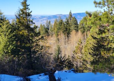
Pacific Crest Views in a short drive from Ashland, Oregon
If you are looking to get up into the mountains for solitude and scenic views, the Pacific Crest Trail (PCT) is always a great choice.
Pacific Crest Trail (PCT) 5 Mile Loop or In & Out
For this 1-2 hour trip, you need to take the Mt. Ashland exit off Interstate-5 and drive toward the Ski Bowl road. A few hundred yards before it, you will see parking on the east side of Hwy 99, across from a communications building. You can park there or continue on to pilot rock road, with an easy-to-find sign on Hwy 99. The hike gains a few hundred feet in elevation. You have the choice of starting from the top or bottom of that elevation (down hill last is my to liking).
To start at the top, drive to the Pilot rock – PCT crossing. You will find parking and a red walk-through gate. Remember, you are going to need to walk back to that elevation. To take the loop and walk back up the road to your vehicle, you walk through the gate on the private access road. Google says the loop is 4.1 miles, but GPS says 5. You can also go out and back on the PCT, but that will increase your trip to 5.4 miles.
To start from the bottom, you will park near the communication building, at the lower road crossing, and hike up hill, on the trail to the east of 99. When you arrive at the red gate after 2.7 miles, you will have found Pilot Rock Road. Walk down-hill on the road to hit Hwy 99. Head north on 99 to land back at the lower trail entrance. Dogs are welcome leash them as you approach others. There is no charge for parking. There are no facilities, but some cool trail bridges, forest and meadows. Lots of neat viewing locations and solitude.
This can have significant snow and ice in the winter. Some snow show it. It usually gets enough traffic for a noticeable trail to be carved. It’s got wonderful high-mountain shade in the summer. There are a couple small bridges and you have a high likelihood of seeing wildlife in warmer months.
by Ryan Mallory


